Preconstruction view studies: photographing a floor that does not exist
A camera is raised to the elevation a future window will occupy and photographs what that window will see. It sounds like a stunt. It is in fact one of the few aerial jobs where the number that matters is not the picture but the elevation reference behind it.
Developers, appraisers and design teams all need the same answer at some point before a high rise is built: what will you actually see from the twenty second floor. A three dimensional model can approximate it, and increasingly does, but a model only knows what has been modelled. A photograph taken from the right elevation knows about the water tower nobody drew, the mature trees along the boulevard, the haze that sits over the river in August and the colour of the light at six in the evening.
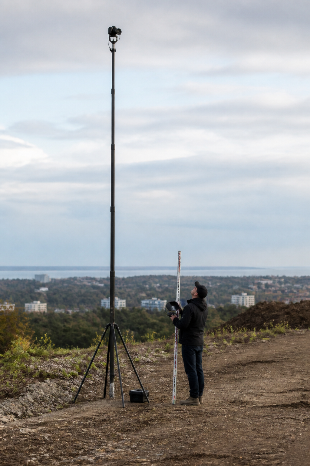
The technique is old and simple. Put a camera at the elevation of the future floor, level it, rotate it through the arc the window will cover, and record what it sees. Cranes, telescopic masts, tethered platforms, small unmanned aircraft and helicopters have all been used to do it. What separates a useful study from an expensive souvenir is not the platform. It is whether the elevation is a measured figure or a guess.
- The reference
- Finished floor elevation, on a stated vertical datum
- Eye height
- Specified above the finished floor, not above ground
- Lens
- Around 40 to 50 mm equivalent, close to unexaggerated seeing
- Record
- Date, time, bearing, elevation, weather, no cropping
The elevation is a survey figure, not an estimate
A view study says something specific: this is the view from level twenty two. That claim only holds if the camera was where level twenty two will be. The chain runs from the vertical datum used by the project survey, through the finished floor elevation of the level in question, to the eye height of a standing observer above that floor, and it has to be written down at every step.1
Two errors recur. The first is measuring from existing ground rather than from the finished floor, which on a site with any slope or any podium can be several metres out. The second is forgetting the eye height above the floor, which is the difference between the view from a window and the view from the concrete slab, and which changes what a parapet across the street hides.
Ten feet of elevation error is invisible in the photograph and decisive in what the photograph shows.
Why the datum comes before the camera
The platforms, and what each one costs you
| Method | Elevation control | Main constraint |
|---|---|---|
| Telescopic mast | Excellent, mechanically measured | Ceiling of roughly sixty feet |
| Crane or hoist | Excellent where one is already on site | Availability, and only on the site itself |
| Small unmanned aircraft | Good with a survey grade receiver, weaker on barometric height alone | Four hundred foot rule and airspace authorisation |
| Tethered aerostat | Good, height read from the winch, corrected for tether angle | Wind, ground footprint, blowdown offset |
| Helicopter | Moderate, and expensive per minute | Minimum altitudes and cost |
| Computed from a surface model | Exact by construction | Only knows what has been modelled |
Note the row that catches people out. A small unmanned aircraft is capped at four hundred feet above ground level, with an allowance to fly four hundred feet above a structure while remaining within four hundred feet of it. A tower whose upper floors sit above that band cannot simply be photographed from the target elevation by a drone flying free over open ground.2 A moored balloon has a five hundred foot ceiling, which is higher but still finite, and a helicopter has its own minimum altitude rules over congested areas.
What makes a study defensible six years later
View studies are looked at again, sometimes long after the building has been sold. What holds up is not image quality but documentation. A study that will survive scrutiny records, for every frame: the elevation and the datum it refers to, the plan position, the bearing, the focal length and sensor format, the date and time, the visibility and cloud, and any processing applied.
- use a focal length close to unexaggerated seeing, around forty to fifty millimetres on full frame, rather than a wide lens that flatters the panorama;
- shoot a full rotation, not only the good direction;
- keep an uncorrected original of every frame;
- photograph in ordinary visibility as well as on the clearest day of the year;
- note what is under construction elsewhere in the field of view on the day.
The honest limits of the exercise
A photograph records the world on the day it was taken. Trees grow, neighbouring sites are developed, and a view that exists in year one may not exist in year six. As a general matter in the United States there is no free standing right to a view: it exists where an easement, a covenant or a specific local ordinance creates it, and otherwise a neighbour may build within their own entitlements.3 Anyone relying on a view study should therefore also be reading the zoning envelope of everything in the frame.
That combination, a photograph for what is there and a computed analysis for what could be built, is why view studies are usually paired with a viewshed analysis rather than replaced by one.4 What a viewshed is, how it is computed and what it does not tell you is set out in the next page.
Notes
- In the United States, project elevations are commonly referenced to the North American Vertical Datum of 1988. A study that quotes a height without naming its datum is quoting an incomplete figure. Back
- Altitude limits for small unmanned aircraft: 14 CFR 107.51. The structure allowance is the reason a drone can work the upper floors of a tower it is flying beside, but not the same elevation out over the water. Back
- General observation about United States practice, not legal advice. Jurisdictions differ, and specific ordinances, easements and covenants govern. Back
- A viewshed computed on a digital surface model includes buildings and vegetation; one computed on a bare earth terrain model does not, and the two give very different answers in a city. Back