Construction progress photography that survives a dispute
A folder of site pictures is not a record. A record is the same station, the same focal length and the same interval, held for the length of a job, with clocks that agree and originals nobody has touched.
Progress photography has four audiences and they want different things. The design team wants to see whether what was drawn is what is being built. The commercial team attaches images to the monthly payment application.1 The marketing team wants one good frame a quarter. And somebody, eventually, may want to establish what the site looked like on a particular Tuesday, because a delay or a defect is being argued about and contemporaneous evidence is what such arguments turn on.
Only the fourth audience imposes real discipline, and it is the one nobody has in mind when the first photographs are taken. The cheap insurance is to shoot for it from the beginning, since the difference in effort is small and cannot be recovered retrospectively.
- Fixed station
- The same point, marked and recorded, every visit
- Fixed lens
- One focal length per station, written down
- Fixed interval
- A cadence set by the phase, not by convenience
- Untouched originals
- Kept separately from anything corrected or cropped
The three fixities
Comparability is the entire product. Two images of a facade taken from slightly different positions with slightly different lenses are two pictures; the same image taken twice from an identical station is a measurement of change. Fixing the station means recording its coordinates and its height, marking it physically where the site allows, and recording the bearing. Fixing the lens means one focal length per station for the life of the job, noted in the station sheet rather than remembered.
For aerial stations the fixity is harder and it is where the platform choice bites. A small unmanned aircraft with a survey grade receiver can reoccupy a coordinate and a heading closely enough that successive months overlay almost exactly. A tethered platform cannot: it goes where the wind leaves it, so the aerial component of a progress record made from a tether is a set of similar views rather than a set of identical ones. That difference, and the rest of the comparison, is on the platform page.
The value of a progress photograph is created entirely by the one taken from the same place a month earlier.
Why the station sheet matters more than the camera
Cadence follows the phase, not the calendar
A monthly visit is a habit, not a plan. What ought to set the interval is how fast the work becomes unrecoverable: anything that will be buried, covered or clad has to be photographed before it disappears, and nothing that happens after that is any substitute.
| Phase | Aerial | Ground | Reason |
|---|---|---|---|
| Enabling and earthworks | Weekly | Daily | Volumes change fast and cannot be reconstructed afterwards |
| Substructure | Weekly | Before every pour | Everything here ends up buried |
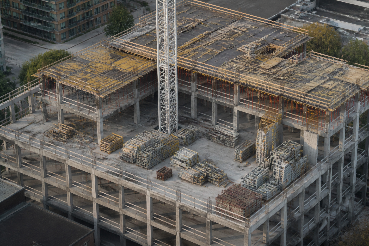
| Superstructure | Per floor cycle | Weekly | Progress is legible from above, floor by floor |
| Envelope | Monthly | Weekly | Facade sequence, and defects while access still exists |
| Fit out | Monthly at most | Weekly by zone | The aerial view stops carrying information |
| Handover | Full set once | Full set once | The reference everyone returns to later |
Clocks, files and the boring part that decides everything
The single most common defect in a construction photography archive is a camera clock that was never set. A file whose recorded capture time is three hours out, or a year out because the body was reset after a battery change, invites an argument about every date in the set. The remedy costs thirty seconds per visit: check the clock against a reliable time source before the first frame, and photograph a board or a phone screen showing the date at the start of each session.2
- keep originals unmodified, in their native format, in a location separate from working copies;
- name files so that station and date are readable without opening anything;
- never crop, straighten or blend an image that is part of the record set, and if a corrected version is needed, make it a derivative and keep both;
- write down what changed whenever the equipment, the station or the interval changes, since an unexplained discontinuity is what an opposing expert looks for;
- back the archive up somewhere the contractor does not control, if the client is not the contractor.
When the picture has to be measured rather than looked at
Earthwork volumes, stockpile quantities and as built comparisons are not photography questions, they are photogrammetry questions. The deliverable is an orthomosaic or a point cloud, produced from an overlapping flight pattern and tied to ground control points whose coordinates are known by survey.3 The distinction is worth insisting on when a client asks whether the progress photographs can also give a cut and fill figure. They cannot, unless the flight was planned as a survey from the outset.
Time lapse sits somewhere between the two. A fixed camera on a mast or a parapet, firing every ten or fifteen minutes through working hours, produces both a marketing asset and, incidentally, a very dense record of when plant arrived and when work stopped. It is not a substitute for the station series, because one viewpoint cannot see a whole site, but it is the cheapest continuous evidence available.
Notes
- In United States practice the monthly application is commonly made on AIA Document G702 with its G703 continuation sheet. Whether photographs accompany it is a matter for the contract. Back
- Capture time is stored in the image metadata as the original date and time field. It records what the camera clock believed, not what time it was. Back
- An orthomosaic is a composite in which perspective has been removed so that every pixel sits at a single scale, which is what allows distances and areas to be measured off it. Accuracy depends on the ground control, not on the camera. Back
- General observation, not legal advice. Back